This travel update is for part two of our one-week stay in Stavanger, Norway. It covers September 7 – 8. “Any text in quotes and Italics has been copied and pasted from some informational website like Wikipedia.”
September 7, 2023 – Thursday: Lysefjord!
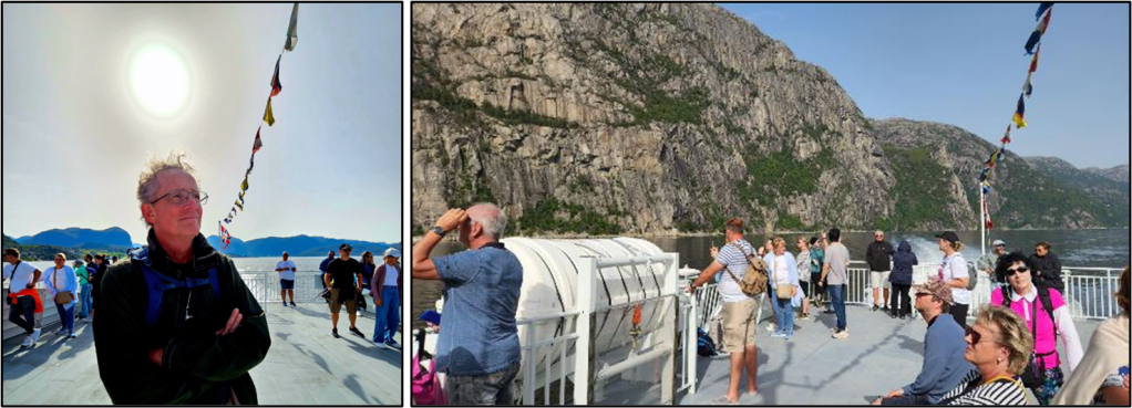
We took the boat to this fjord today.
“Lysefjord or Lysefjorden is a fjord located in the Ryfylke area in Rogaland county in southwestern Norway. The 42-kilometre (26 mi) long fjord lies in the municipalities of Strand and Sandnes, about 25 kilometres (16 mi) east of the city of Stavanger.
The name means light fjord, and is said to be derived from the lightly colored granite rocks along its sides. It is particularly well known for the huge Preikestolen cliff overlooking the fjord, which is a major tourist destination for the region. The fairly isolated village of Lysebotn lies at the eastern end of the fjord and the villages of Forsand and Oanes both lie at the western end of the fjord near the Lysefjord Bridge, the only crossing of the fjord.”
We ate an early lunch at home then walked down to the harbor to catch the boat. There were two cruise ships there today. And the two smaller boats in this picture were taking tourists to the fjord. We got on one like that.
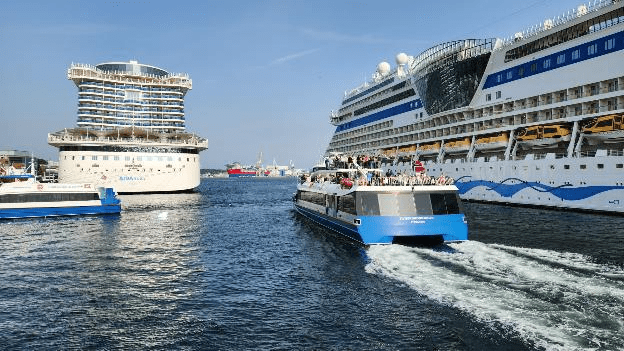
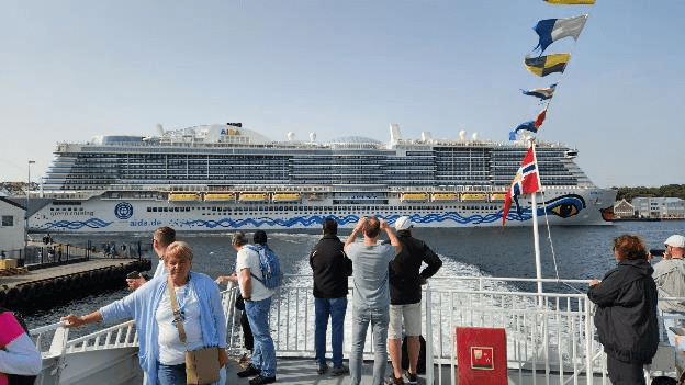
While we were in line to get on our boat we talked to the German tourist couple behind us who were on one of the cruise ships. They left from the port of Kiel in Germany and are having a “shore excursion” to Lysefjord today. As we left the harbor, we had a nice view of their AIDA cruise ship off our stern. All the AIDA ships we’ve seen have the woman’s lips, eyes, and hair as a decoration at the bow.
The dotted red line on this map shows today’s boat route.

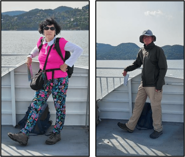
Patti struck one of her typical poses against the rail, and then wanted me to try it too. I think I captured the spirit of the pose fairly well, what do you think?
The captain slowed down as we went around the island of Ådnøy which is fairly well known for pretty views.
“For maybe more than 1000 year there has been farming at Ådnøy, the island laying where Høgsfjorden meet Lysefjorden, half way from Stavanger to Pulpit Rock.”
We saw houses, farms, boathouses, trees and hills on the island.

Then we got to the entrance to the Lysefjord, that has a bridge across it.
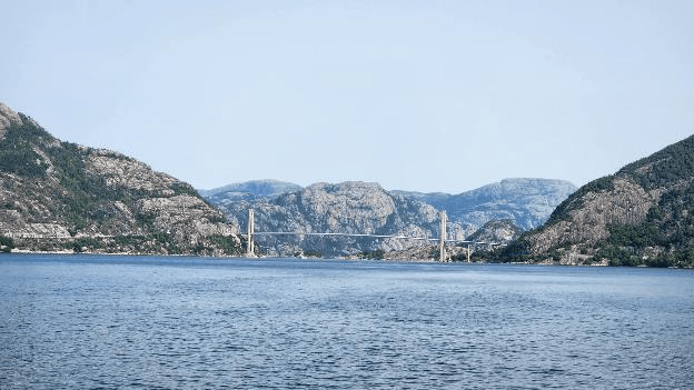
“Lysefjord Bridge Norwegian: Lysefjordbrua is a suspension bridge over the Lysefjorden in Rogaland county, Norway. The bridge connects the municipalities of Strand and Sandnes. Construction on the 639-metre-long bridge began in 1995 and was finished in 1997 at a cost of 150 million kr.”
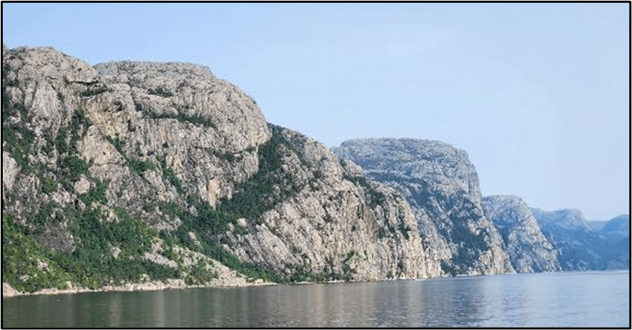
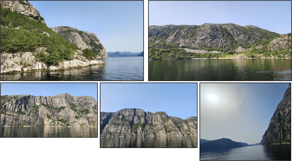
We headed into the fjord, where there are multitudinous scenic views.
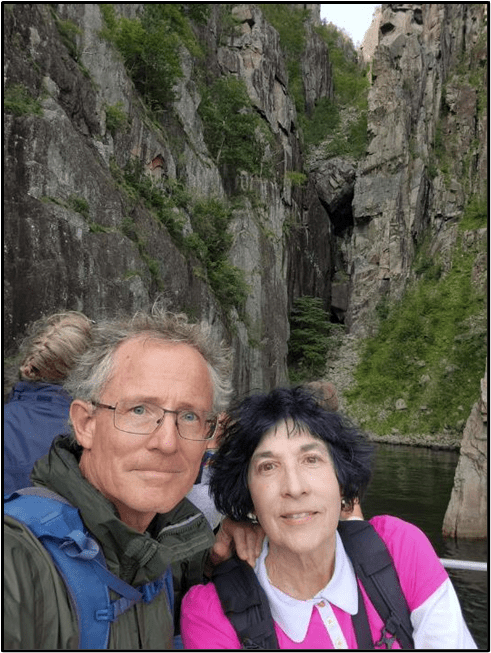
Here’s our picture at one of the inlets that the captain took us into.
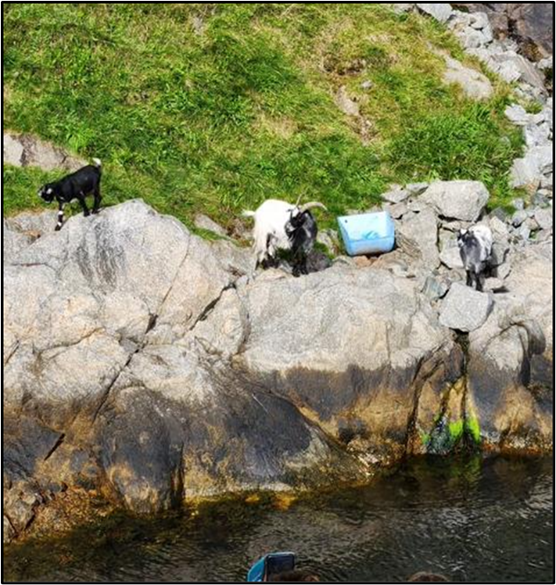
At one place some goats were waiting for boats to come by and throw food to them, which several of the crew members did.
We passed Preikestolen, AKA Pulpit Rock, where we will hike to tomorrow. It’s a very flat projecting shelf of rock at the top of the cliff that overlooks the fjord.
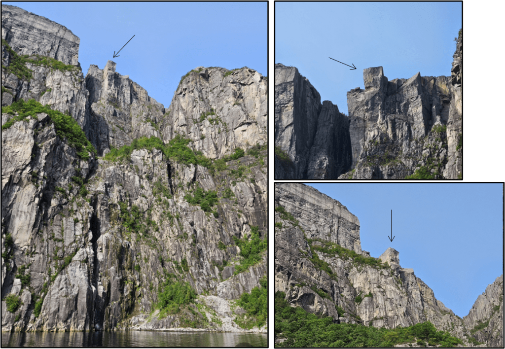
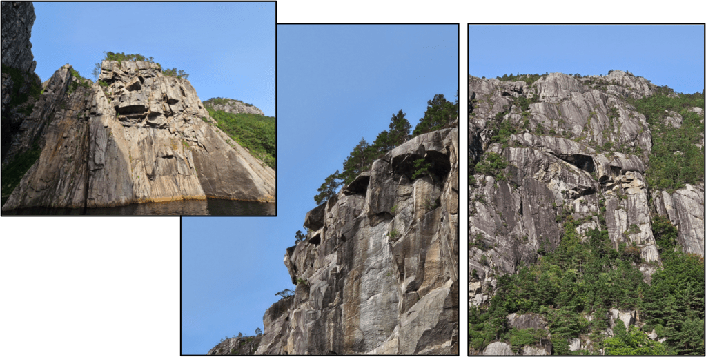
We’ve been looking for trolls as we travel around Norway. They are disguised on the sides of mountains but sometimes you can make out a feature or two. In the pictures below we thought we saw the two eyes and nose of a large troll, can you see it?
Below are several more pictures of the views we saw along the fjord.

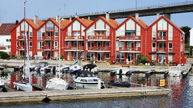
Coming back into harbor we had a nice closeup view of the waterfront houses with their marina. I think that it would be nice to be able to park your boat right in front of your house!
After getting off the boat, I walked on home and Patti walked through downtown to do some shopping.
September 8, 2023 – Friday: Hiking Preikestolen!
Yes, this was the day for the popular Preikestolen Hike.
“Preikestolen or Prekestolen (English: ‘The Pulpit Rock’, ‘Pulpit’, or ‘Preacher’s Chair’) is a tourist attraction in the municipality of Strand in Rogaland county, Norway. Preikestolen is a steep cliff which rises 604 metres (1,982 ft) above Lysefjorden. Atop the cliff, there is an almost flat top of approximately 25 by 25 metres (82 ft × 82 ft). Preikestolen is located near the Western part of the fjord, and on its North side.
Tourism at the site has been increasing in the early 21st century, with between 150,000 and 200,000 visitors in 2012, making it one of the most visited natural tourist attractions in Norway. BASE jumpers often leap from the cliff. Due to its increased popularity, the most used path to the site (a 3.8-kilometre (2.4 mi) long hike) was improved by Nepalese Sherpas in 2013.”
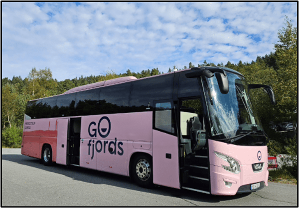
Since we were going to be doing a lot of walking today on the hike we took the #4 bus instead of walking from our Airbnb to the Radisson Blu Hotel where we met the bus — it was pink!!! We had reserved tickets on the Express Bus which were about $45 USD per person for the 45-minute ride.
We took some bus selfies, including some “reflection” selfies that Patti took into the bus’s rear-view mirror.

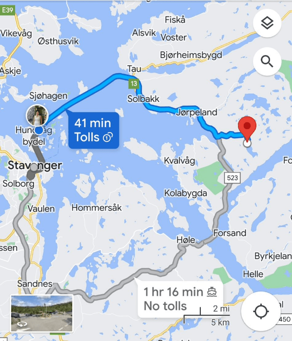
The driver told us we would be going through a tunnel under the sea that was 14 km long. He said it was the longest undersea tunnel only for cars and buses in the world. Here’s the route, in blue, from Google Maps.
We had the front seat directly behind the driver, so we had a good view of the tunnel.
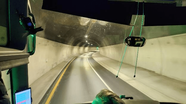
“Ryfast is a subsea tunnel system in Rogaland county, Norway. The tunnel system is part of the Norwegian National Road 13, and it runs between the city of Stavanger in Stavanger Municipality, under a large fjord, and the area of Solbakk in the municipality of Strand.
When the last section was drilled on 26 October 2017, Ryfast became the longest undersea road tunnel in the world, with its 14.3-kilometre (8.9 mi) length greater than the Eysturoyartunnilin in the Faroe Islands at 11.2 kilometres (7.0 mi), the Tokyo Bay Tunnel in Japan at 9.6 kilometres (6.0 mi), and the Shanghai Yangtze River Tunnel at nine kilometres (5.6 mi) in China.[3] It is also currently the world’s deepest subsea tunnel, reaching a maximum depth of 292 metres (958 ft) below sea level.”
It was definitely a long tunnel!
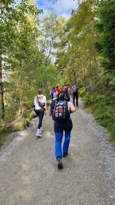
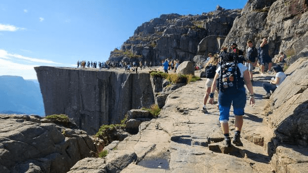
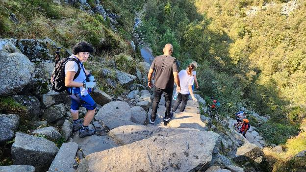
The bus dropped us off at the Preikestolen Base Camp where there is a hotel, restaurant, gift shop, toilet, and drinking water. We had five hours, 11AM to 5PM, to accomplish the hike and be back on the bus. I was a bit stressed out about that since we typically hike very slowly. So, we had developed a plan where we would hike steadily, not making lots of stops to take pictures along the way, and hopefully not miss the bus. So when we got off the bus we quickly headed up the trail which was well marked and there were LOTS of hikers on it.
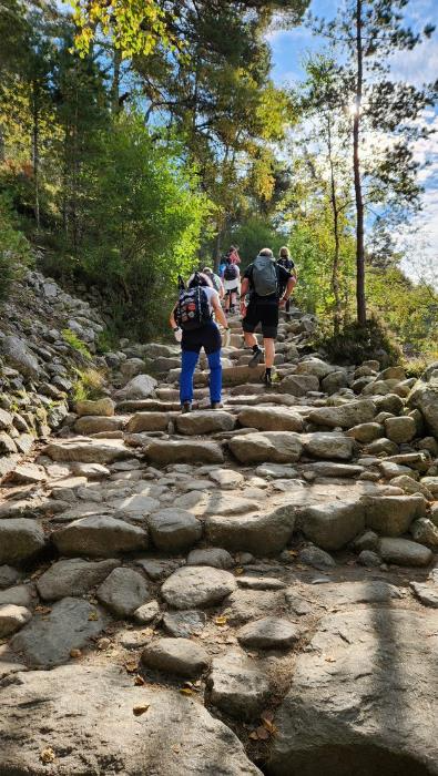
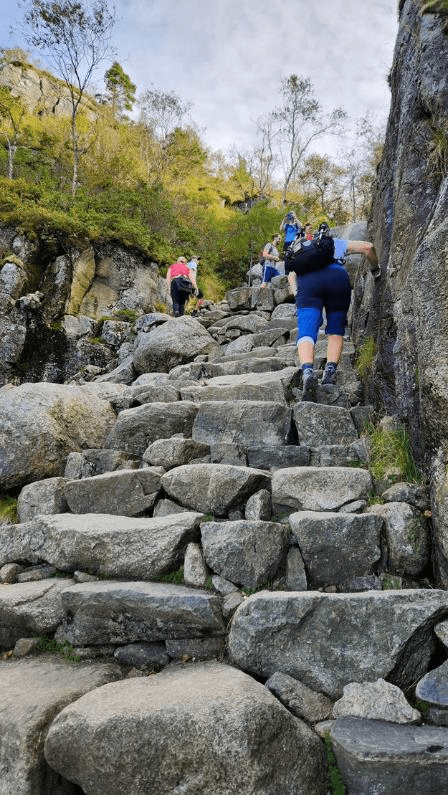
Soon we got to some of the steps probably built by the Nepali sherpas.
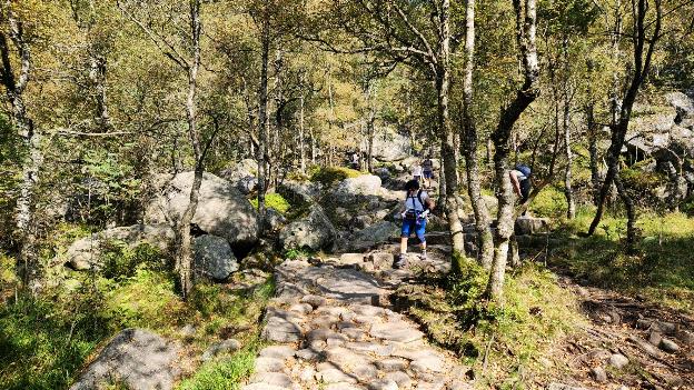
There were flat places where we forded streams and crossed boulders.
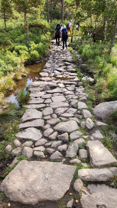
These steppingstones through a swampy area were nice-looking.
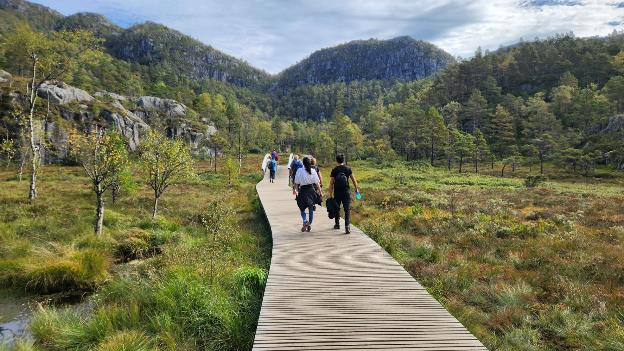
In some places there were wooden boardwalks. The Moire Pattern on the boardwalk in this picture is probably just an artifact of the image compression algorithm.
Some of the uphill climbs were up rock stairs and I got pretty winded on some of them. Most people on the trail were climbing faster than us, but they were also younger than us.
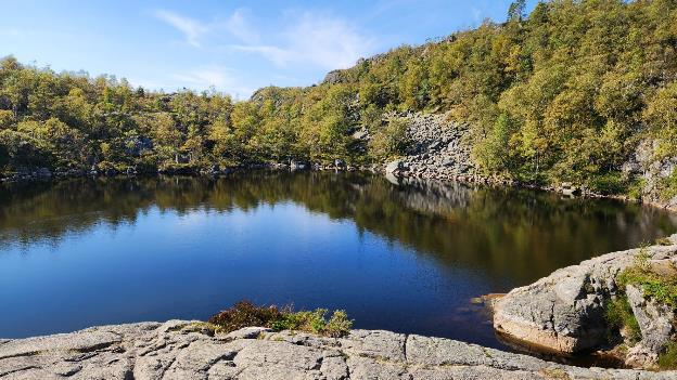
We passed an area where there were small lakes, it was very picturesque.
The weather was very nice and there were places where the walking was pretty easy.
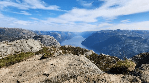
Towards the top we had nice views of the Lysefjord which we’d seen from the boat yesterday.
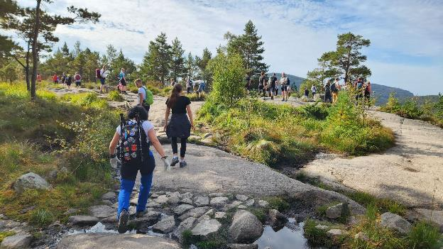
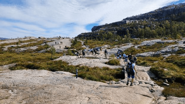
And here’s Patti 100 yards from our goal. You can see all the hikers out on Pulpit Rock in the distance to the left.
We made the uphill hike in just under 2 hours. Here’s what my Samsung Health app recorded. Our average speed of 1.5 miles per hour was faster than we usually hike so I was happy.

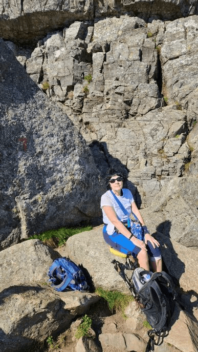
On Pulpit Rock there were a lot of people hanging out, chatting, and eating lunch. We found a spot and ate our lunch that Patti had made yesterday, chicken with risotto and carrots. Here’s our lunch spot.
Here’s the view of the fjord from our lunch spot.

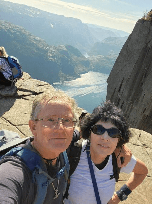
Here’s the obligatory selfie.
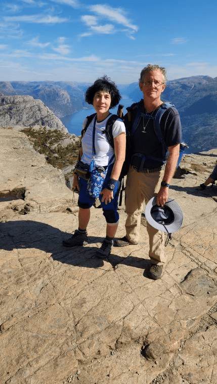
Another hiker offered to take our picture.
The hike down was a little faster than going up, but not by much. Going down the steps feels quite different than going up and I feel like I have to take more care choosing my next step.
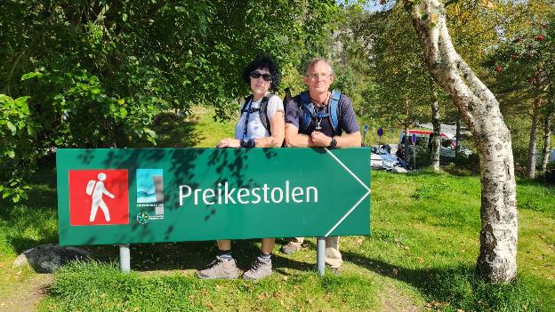
We got back to the base camp about 45 minutes before the bus would arrive so I was happy with our time. We looked into the gift shop and got someone to take our picture with this sign.
Then we waited for the bus, which arrived on time, and it was a comfortable ride back into Stavanger.
I was, however, sore in several places, feet, knees, shoulders, hips, and back mostly. I dislike not being able to do hikes like this pain-free, like I used to be able to do. It’s possible I am a victim of old age. So, instead of walking home from the bus stop we took the local #4 bus home.
