This travel update is for our two-day stay in Narvik, Norway. It covers August 18 – 19. “Any text in quotes and Italics has been copied and pasted from some informational website like Wikipedia.”
August 18, 2023 – Friday: Driving to Narvik
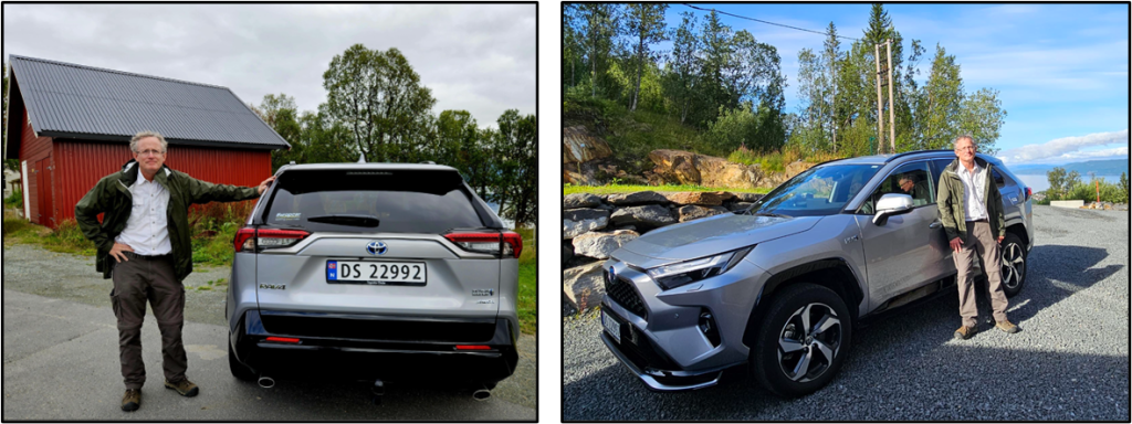
We were up early this morning in Tromsø. We packed up, loaded the rental car, and headed out by 9AM. Here’s a couple of pictures Patti took of me with the rental car. It’s an almost new Toyota RAV4 (plugin hybrid). ICYDK, RAV4 is the acronym for Recreational Active Vehicle with 4-wheel-drive.
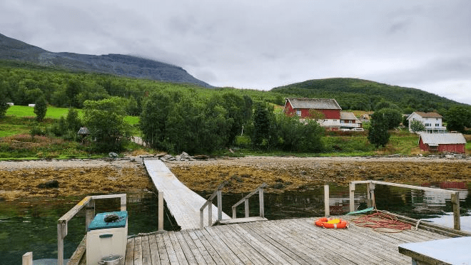
We drove about an hour and got to the farm where Patti’s niece, Callie, has been working as a WWOOFer (Worldwide Opportunities on Organic Farms) — I wrote about her in an earlier post. Earlier this week, we made plans with Callie to stop by to see her on our way to Narvik, and to get a tour of the farm and eat lunch.
The farm is along the edge of a fjord. I took this picture from the dock looking at the farm buildings and some of the fields.
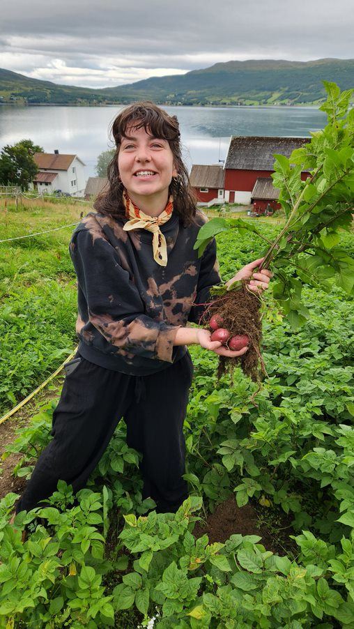
Callie gave us a tour of the farm. Here she’s showing us some potatoes that she just pulled out of the ground.
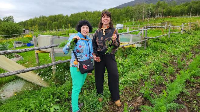
Patti participated in pulling Carrots.
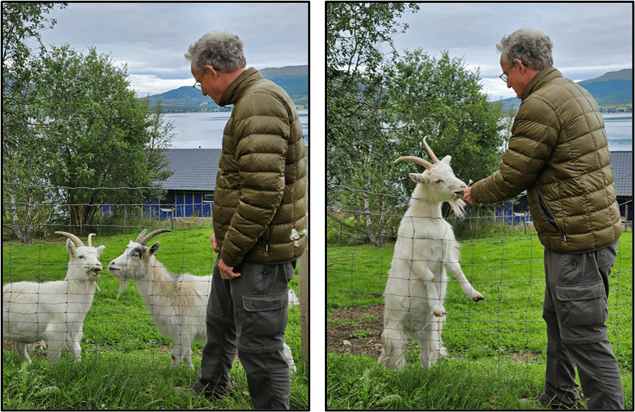
I fed flowers to the two goats.
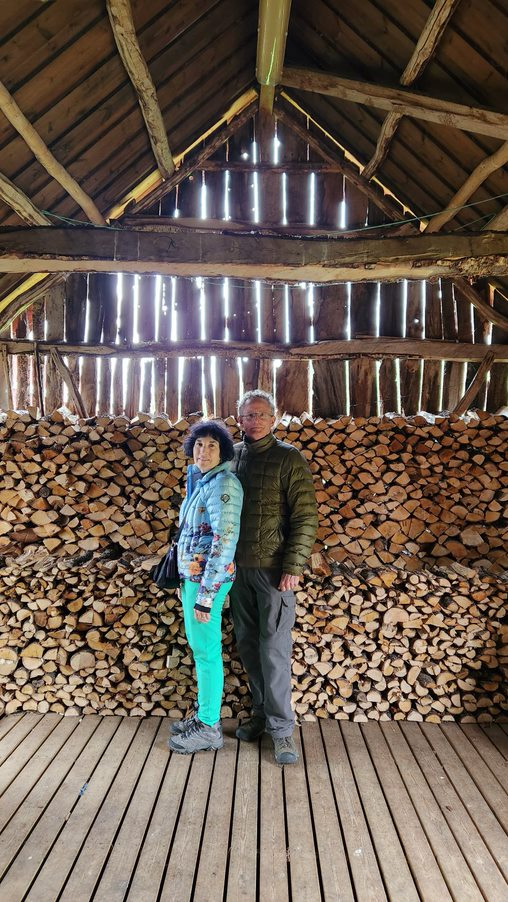
There’s a small wooden barn where they stack firewood for the winter. Here we are with the firewood.
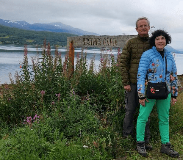
Here we are with the sign, Nordre Hestnes Gård, which means something like “Northern Horse Farm”.
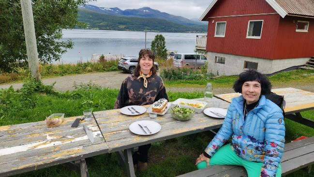
Callie prepared a lunch of fresh everything, salad, bread, eggs, and cheese, which was quite good, and we had a view of the fjord while we ate. She also made a carrot cake.
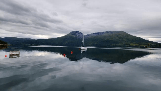
The farm has a sailboat that they keep out on the fjord. The water was quite calm today.
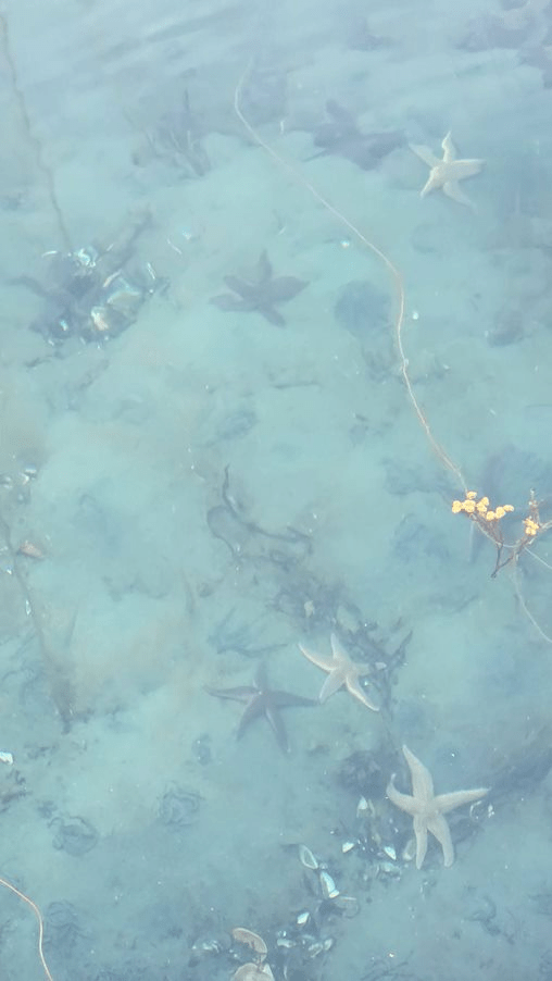
And from the dock you can see lots of Sea Stars on the bottom.
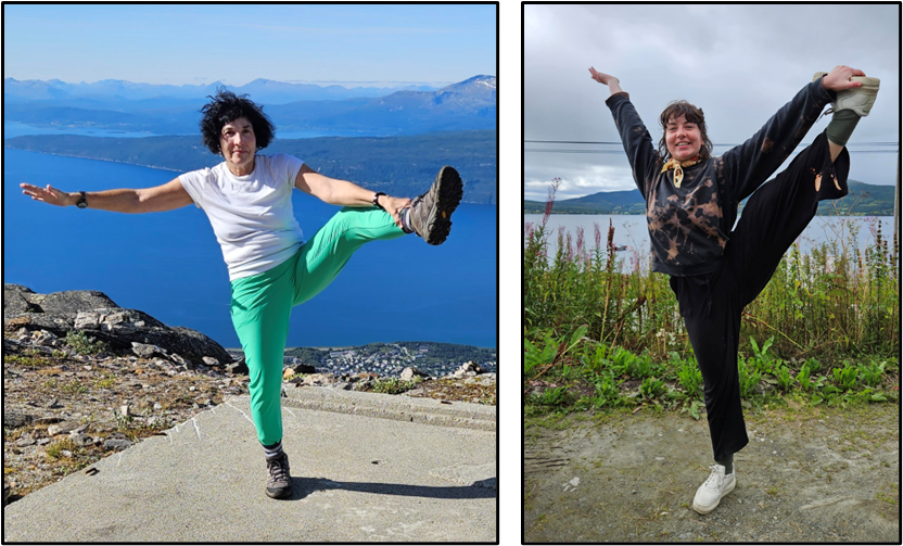
Before we left, Patti showed Callie one of her balance poses that she usually does every day. Of course, Callie, who had 10+ years of dance lessons and performances, had no problem doing the pose. I believe she actually “up-staged” Patti somewhat by being able to lift her leg pretty much over her head and touch her foot. The best Patti can do is lift her leg almost shoulder height and touch her ankle — still pretty impressive for a 63 year-old female.
We had a nice visit with Callie, then we dropped her off at a nearby bus stop because she wanted to go north into Tromsø. We headed south.
Today’s drive was mostly south through valleys.

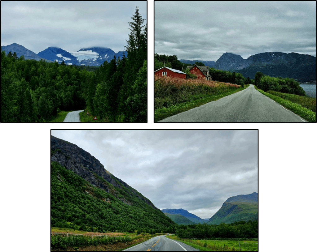
The scenery was quite spectacular, it seemed like the mountains, fjords, rivers, and forests just kept coming, each more beautiful than the last. Patti took a lot of pictures of beautiful scenery while I drove. We saw lots of glaciers along the route. The picture on the top left is of a glacier.
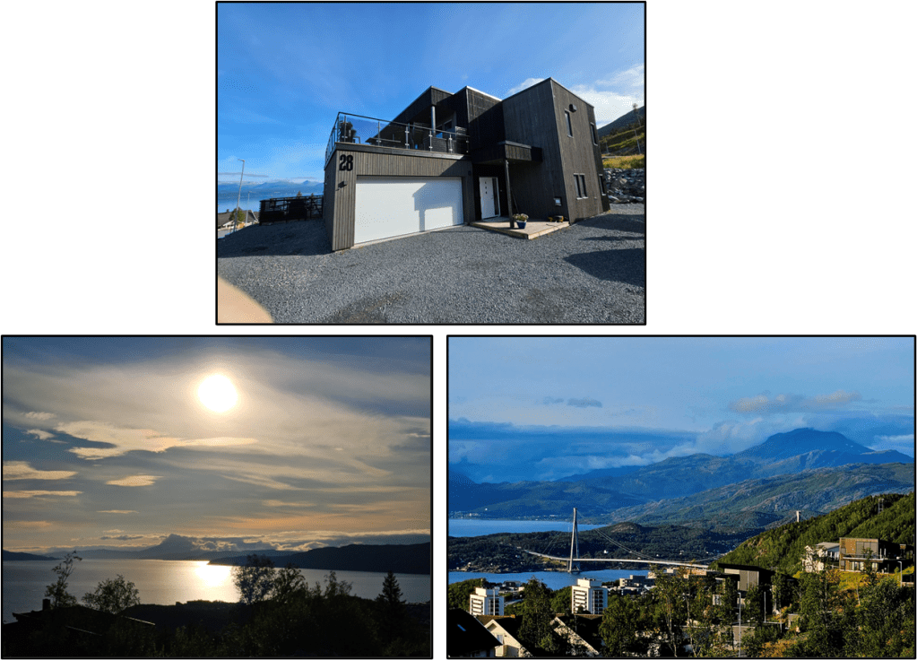
We got to our destination, Narvik, around 5PM and first went by a grocery for provisions then found our Airbnb and settled into it. It is a very nice place. We are in a one-bedroom apartment that’s part of a larger house. Here’s the house from across the road, along with two photos of our view — one of the best things about this Airbnb is we’re on a hill with nice views of the mountains and fjords.
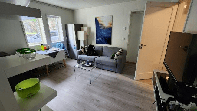
Living room/kitchen/dining room is cozy.
As is our bedroom.

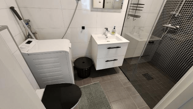
The bathroom is pretty roomy with a large shower.
It’s a comfortable place. We are staying here for two nights.
August 19, 2023 – Saturday: Hiking To Linken
Before I talk about today’s hike, here’s some history on Narvik.
“Narvik is a town and the administrative centre of Narvik Municipality in Nordland county, Norway. The town is located along the Ofotfjorden in the Ofoten region. The 6.78-square-kilometre (1,680-acre) town has a population (2018) of 14,141 which gives the town a population density of 2,086 inhabitants per square kilometre (5,400/sq mi).”
Some of the popular historical facts about Narvik are about the Battles of Narvik.
“The Battles of Narvik were fought from 9 April to 8 June 1940, as a naval battle in the Ofotfjord and as a land battle in the mountains surrounding the north Norwegian town of Narvik, as part of the Norwegian Campaign of the Second World War.
The two naval battles in the Ofotfjord on 10 April and 13 April were fought between the British Royal Navy and Nazi Germany Kriegsmarine, while the two-month land campaign was fought between Norwegian, French, British, and Polish troops against German mountain troops, shipwrecked Kriegsmarine sailors and German paratroopers (Fallschirmjäger) from the 7th Air Division. Although defeated at sea off Narvik, losing control of the town of Narvik and being pushed back towards the Swedish border, the Germans eventually prevailed because of the Allied evacuation from Norway in June 1940 following the Battle of France.
Narvik provided an ice-free harbour in the North Atlantic for iron ore transported by rail from Kiruna in Sweden. Both sides in the war had an interest in securing this iron supply for themselves and denying it to the enemy, thereby setting the stage for one of the biggest battles since the Invasion of Poland.”
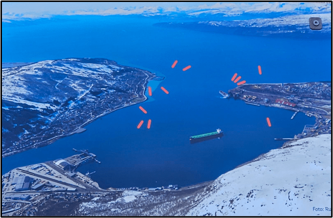
We’ve seen signs along the roads in Narvik about particular locations where battles were fought, so it’s a pretty big deal here. We saw the sign below on today’s hiking path that said a total of 36 ships were sunk in the inner harbor during the three-month Battle for Narvik. 12 shipwrecks are still lying in the inner harbor as indicated by the red ships.
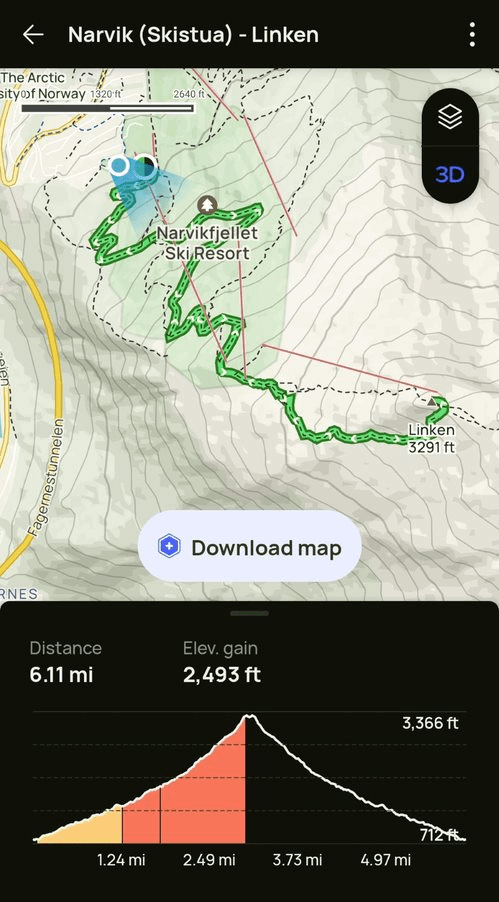
We decided to do a popular hike today up to the summit of Linken. I used AllTrails to help with navigation, here’s what it shows about the hike. It was about 6 miles round trip with about a 2,500 foot elevation change.
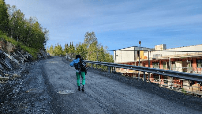
The first two miles were on a dirt and gravel road that was an easy walk.
We went by this camp where they’ve got replica teepees like the Sami (local indigenous) people lived in.

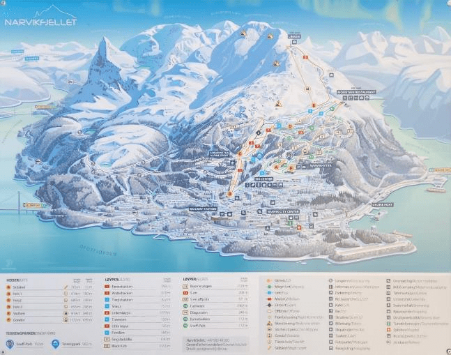
The road ended at the upper cable car station of the ski resort Narvikfjellet which is a pretty large one. Here’s a map of the routes and lifts and it also shows the town of Narvik at the bottom. I think Narvik is a popular skiing destination in the winter.
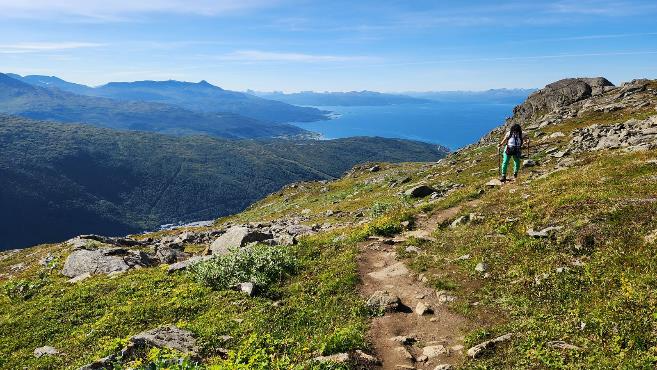
From the upper cable car station we hiked up the last mile over the well-worn hiking path to the peak where there’s a big antenna. Here’s Patti on the trail.
Here are some pictures Patti took of me along the hike. She also took a picture of this guy (top left) whose path we crossed along the trail. Typically, hikers are carrying backpacks. This guy was carrying a grocery bag — quite an unusual accessory on a hike we thought.
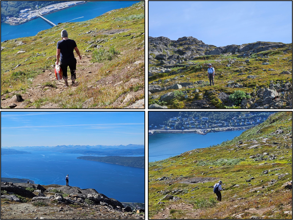
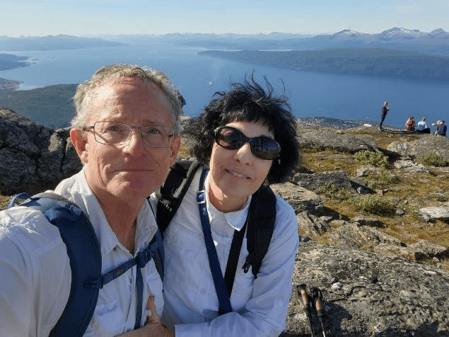
At the summit we got our selfie with the fjord. We both had on white shirts today.
Of course the view from the summit was beautiful.

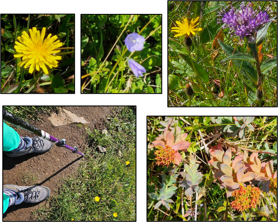
There were pretty plants and flowers along the route.
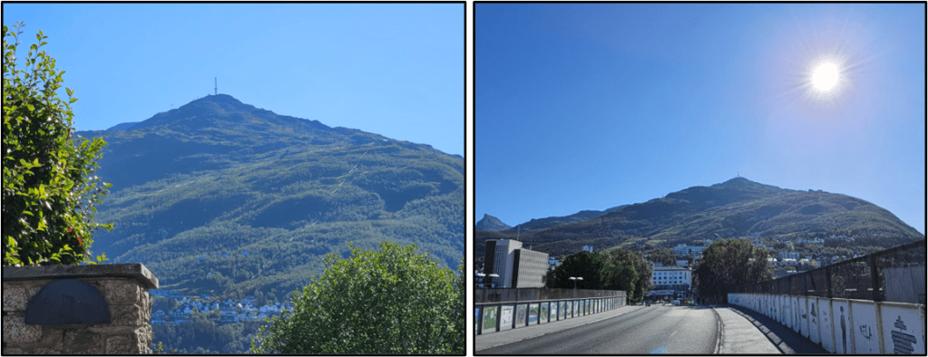
Below are two pictures taken from a distance of the mountain we hiked up today. The summit has a cell phone tower you can see in these two photos.
Today was had good weather day and there were many lovely things to see along the hike up and down the mountain. We’ve heard that getting outdoors and exercising is one of the things people in Norway enjoy. Indeed, there were a lot of people on the path today both walking and biking. There was a mountain bike trail on the mountain. We watched one guy get started on it by jumping the first ramp and then quickly disappearing down the trail. Hiking is, sensibly, prohibited on the mountain bike trail.
After the hike we went back to the Airbnb and relaxed. Tomorrow, we drive to the Lofoten Islands to Stamsund!
